Choosing a navigator for a truck is not an easy task. This device has much more specific requirements in comparison with devices that are installed on a passenger car. For example, a navigator for trucks should have additional features so that the driver can easily get the desired route by entering data. There are other nuances that are important to consider when buying a device.
What features should a navigator for trucks have?
A modern navigation device for a truck should allow you to set the following parameters:
- vehicle dimensions;
- maximum axle load;
- mode of movement;
- cargo weight;
- body capacity;
- load capacity;
- category of transported materials, taking into account the hazard class.
Based on the given parameters, the navigator determines the best route. In order for the software of the device to really determine the best route, you must remember to download maps in a timely manner. Obviously, most of the navigation devices cannot be used on trucks, as they do not have the necessary functionality. Many devices meet the requirements only partially and are therefore unsuitable for professional use. A driver who is trying to find a good navigator for a truck quickly realizes the seriousness and complexity of the task.

Screen and Active Lane Guidance
For the convenience of the driver of a heavy truck, a GPS navigator must have a sufficiently large display. It will provide convenient perception of information along the entire route of the machine. As practice shows, a screen of 7 "" will be enough.
How to choose a navigator for a truck that will provide the driver with maximum comfort when driving a vehicle? Professionals advise to pay attention to new models with advanced features. In recent years, models have begun to appear that have a unique ALG (Active Lane Guidance) function. Such devices are able to tell the driver which lane will be optimal for driving at the moment. When using the ALG function, the device screen is logically divided into 2 parts. When the software detects a curve, intersection or exit ahead, it displays the required lane in advance.
To make driving on international highways safer, you can connect a rear view camera to the navigator. It is purchased separately. To connect it, the device must have a video input.

Route planner
The navigator comes preloaded with maps. However, not all countries may be available by default. Therefore, it is worth worrying in advance about the availability of the desired card in your device. High-quality navigator for trucks allows the driver to easily set the route. The ability to specify multiple destinations at once should be supported. The software of the device automatically suggests the best route.
Modern navigation devices for trucks support the Trip Planner function. It allows you to plan routes by specifying several points at once. The selected configuration can be saved for future trips. In the future, it can be loaded from the device's memory.
Update map data and traffic
If the above information still did not help clarify the question of which navigator is best for trucks, it is worth exploring other useful features of this class of devices in more detail. Perhaps their presence will be a decisive factor for someone to buy a particular model.

So, the navigator can be equipped with a built-in FM receiver that monitors traffic. This information will allow the driver to avoid traffic congestion in a timely manner. He will receive timely information about traffic jams and delays along the route caused by the repair of the route. More detailed information about the traffic situation, about alternative routes are called up with one touch on the screen. The traffic tracking service is available in Russia and in European countries. Not every navigator for trucks supports this feature. Therefore, its presence can be an unambiguous recommendation for the purchase of the device.
The mapping data must be updated regularly by the manufacturer. You just need to ensure that the device has access to the network. The procedure can be performed several times a year. It does not require a special subscription. In addition, map updates should be completely free of charge for as long as the device is in operation. Thanks to this function, the driver will always have the most up-to-date navigation data.
Providing data on service points for trucks
It is important that a truck navigator provides additional information that matters to professional drivers. The category of such information includes data that allows the driver to find out where is:
- a place to stop a freight vehicle;
- parking;
- filling station;
- hotel;
- weight station;
- point with Internet access;
- a car service that provides services for the maintenance and repair of heavy vehicles.

Logging and additional information
The information provided should be more than enough to deal with the question of which navigator for a truck is best suited. An additional benefit would be the device's support for IFTA reporting. In this case, the device automatically records data on the distance traveled, fuel consumed, hours of travel.
The navigator analyzes the time the driver spends behind the wheel and automatically displays a warning about possible processing. Upon receipt of such a message, it is recommended to find the nearest parking lot on the map and take a break for at least 2-3 hours. A professional navigator for trucks is able to warn about the condition of the roadway, the height of the bridge, adverse weather conditions, sudden changes in terrain, and the branches of trees that are too low.
Navigators for trucks differ, first of all, in software that takes into account the dimensions and weight of the vehicle when laying the route. Without such equipment, there is a huge risk of increasing the cost of extra mileage or becoming a violator of traffic rules (In Europe, this is an expensive pleasure), and in the worst case, without calculating the dimensions of the truck, arrange a many-kilometer traffic jam, stuck in a narrow tunnel or under a bridge. Also, one should not forget to make an adjustment for the difference between domestic road realities and transport conditions in the rest of Europe.
The review below offers a rating of the best navigation systems for trucks. The models taking part in it are selected on the basis of technical parameters and feedback from truck drivers who used them in business.
TOP 5 best navigators for trucks
5 XGODY 740
Best price. Reliable reception of GPS satellites
Country: China
Average price: 4,500 rubles.
Rating (2019): 4.3
An excellent navigator for heavy vehicles, made of high quality material and has a special sun visor for a better view of the information on the screen. The 7-inch touchscreen monitor gives you a large image that you don't need to look at, which does not distract from driving a truck. Confident operation and high accuracy of the received coordinates is provided by the 20-channel Sirf star IV GPS module. For navigation, iGo software is preinstalled with the latest map updates for Europe and Russia.
Drivers note the convenience of working with the program, good detail and a sensitive screen. The reviews also positively assess the accuracy of determining the current coordinates, which allows demonstrating the location of the navigator with a minimum error. The available FM transmitter (allows you to tune in to the frequency of the radio) and a speakerphone will be useful on a long trip.
4 Pioneer 7009 Truck

Excellent system performance
A country: Japan (made in China)
Average price: 4 990 rubles.
Rating (2019): 4.5
The navigator is equipped with iGO Primo 9.6 software, designed to work with trucks. It is enough to enter the main parameters (dimensions and tonnage) so that when laying the route, the computer takes them into account, choosing the appropriate roads (in Europe this is of great importance). For a spacious truck cab, a 7-inch screen will be the best solution. In addition, the existing multimedia capabilities will allow you to watch videos downloaded to a micro SD card while relaxing.
In general, truck drivers involved in international traffic are satisfied with this model. The navigator will not lead them to the center of a transit city or to a low bridge (under which it is impossible to pass), but will lay out the best route, without insurmountable obstacles. The cost of the device, comparable to the navigation devices of a conventional car, also deserved good reviews. The MStar Cortex A9 processor with a frequency of 800 MHz maintains a comfortable application speed without causing negative emotions from the owner.
3 NAVITEL A737

Better map detail
Country Russia
Average price: 5 990 rubles.
Rating (2019): 4.8
A high-tech device for compiling and controlling traffic along a given route using a GPS system. Designed for correct functioning with heavy vehicles, takes into account the mass and dimensions when calculating the trajectory. The processor with a frequency of 1 GHz and the same gigabytes of RAM ensure the flawless operation of the Navitel software. The 7-inch touchscreen monitor supports a screen resolution of 1024x600 pixels for clearer, richer images.
The owners deservedly consider this navigator to be the best solution for using trucks in the CIS - it has the most detailed road maps of the Commonwealth countries. The reviews also positively assess the correctness of the route construction, the small error of the current coordinates due to the excellent search and capture of signals from satellites (supports GPS and GLONASS). The Android 6.0 system on which the device runs also allows you to use the navigator as a full-fledged tablet - there are front and rear cameras, Wi-Fi, GPRS support (for 2 SIM cards) and much more.
2 Garmin Dezl 770 LMT

Free map updates for Europe and current traffic conditions
Country: USA
Average price: 62,900 rubles.
Rating (2019): 5.0
A high position in our rating is occupied by a navigation system with a huge 7-inch screen and installed software adapted for trucks, which allows you to rationally draw up a route, taking into account the type, dimensions, weight of the vehicle and even the type of cargo. A feature of this model is unlimited free access to updates of maps of European countries and the current state of road traffic. It is possible to connect a rear view camera (type - BC30), synchronize with the owner's smartphone (supports the transfer of current location coordinates, parking places, can receive calls and much more).
The navigator allows you to calculate the approximate time of arrival at your destination, records the time spent on the road, has voice control, and a high speed of route calculation. In the main menu there is a maintenance subsection, where it is very convenient to store information about the performed and upcoming maintenance work. Some reviews positively note the work of such a function as ALG (lane selection), the precise operation of the navigator saves fuel, time and makes the driver's work as easy as possible.
1 TomTom GO PROFESSIONAL 6200

The best guide on European roads
Country: Netherlands
Average price: 29,900 rubles.
Rating (2019): 5.0
This navigator is one of the best for organizing and planning freight traffic in Europe. The LIVE-service system, upon activation of an annual subscription, allows you to update information on the location of radars in real time (there is also a built-in detector) and tracking cameras, learn in advance about traffic jams along the route, receive weather conditions, maintain correspondence with your dispatcher and much more.
Not only does the My Drive system map the traffic correctly, which is of great importance for a truck, but thanks to TomTom Traffic, it allows you to change direction in a timely manner, avoiding long delays on the road due to traffic jams. In their reviews, drivers note the high speed of the device - it not only quickly calculates the route, but also has the PhotoReal function, which clearly and in advance demonstrates which lane the truck should be in before the traffic intersection. The free map updates throughout the life of the navigator are also highly appreciated by the owners.
In order to always easily find the right way in any city and in any place, most people use GPS navigators, but technology does not stand still: now you can have a convenient and fast navigator right in your smartphone. The Yandex service provides its users with a free Yandex.Navigator application, which is designed to take you anywhere in the city in the shortest possible way. The application is equipped with speakers, comments from other users, up-to-date data on traffic on the roads, traffic jams and repairs. Download this program for yourself and learn how to use it with the help of this article.
Downloading Yandex.Navigator and specifying the path
- You can easily download the Navigator from Yandex in the Play Market or the AppStore. Click "Install" after finding the app and wait a few seconds.
- Now sign in to the app. To find yourself on the map, you need to turn on location data on your phone. Open the tray of the device by swiping down the screen with your finger, click on the “Geodata” icon and wait until it changes color.

- Now your current location will be instantly determined.
- Pay attention to the bottom panel in the program: all the necessary tools for working with the navigator are located here. The most important thing is finding a route. Try to pave your first path right now. Automatically your location is determined as point "A". Find your destination on the map and click on it.

- If you do not know where the place you are looking for is located, then just click on the “Search” icon. In this menu, you can either enter the address or name of the place, or search for it in the categories.


- As soon as the system determines the available list of places, click on the one you need.

- Now you see the possible options for point "B" on the map.


- Click on one of them, and then select the "Let's go!" field.

- That's all. The path is automatically set. If you have several route options, the time and kilometers for each of them will be indicated on top. The system will also notify you of traffic jams and repairs.

- Follow your path on the top bar. These tools will be very useful to you to quickly navigate the road.


How to add favorite places to Yandex.Navigator
To navigate in just a couple of seconds, you can add the most frequently visited places to a special list.
- Open "My Places".


- Here you will see handy bookmarks like "Home" and "Work". Add addresses or points on the map to them.
- In the “Recent” section, you have access to all the addresses that you have recently visited.


How to log in to Yandex.Navigator
Users authorized in the system can synchronize all settings on devices. This is very handy if you have multiple phones or if you suddenly get lost with a friend who has such an application.
- Press “Menu” again and then the “Login” button.


- The convenience of the system is that you can use not only a Yandex account for authorization, but also any social network.
- As soon as you sign in and give the application access, authorization is complete.

How to set up Yandex.Navigator
The application has a user-friendly interface and many flexible settings. By selecting the “Settings” item in the menu, the following options become available:
- Map view from satellite or schematic.
- North location.

There are some minor points of interest:
- Announcer's voice. There's even Optimus Prime here.
- Setting up an appeal to Yandex by the command “Listen, Yandex”.
Customize the application to suit your needs and tastes.

Yandex.Navigator tools
The menu has a separate item "Tools". You should know why you need it.
Here you can mark your fines so that you always remember them, store your trip history, quickly find nearby car towing companies, commissioners. Don't forget to add penalties so that the app reminds you of them.


How to add a mark on the map in Yandex.Navigator
If you witnessed an accident or saw repair work on the road, you can notify other drivers about it.
- Click on the location on the map where the blockage occurred. Select the triangular road sign icon on the left.


- Now note what exactly happened on the road and select a lane if necessary. You can also just leave a comment on this place by clicking on the gray icon.
- So simply you can connect with other drivers right in your navigator.


For trucks choose. Indeed, in all cities there are such streets where it is forbidden to move this type of transport. In order not to waste time and not create additional problems for themselves, manufacturers suggest paying attention to navigation equipment. The range of such equipment is currently quite large. On the shelves there are both budget models and more expensive ones. How not to get lost in this choice?
We offer to consider the Navitel A730 GPS-navigator. This model is universal, it is perfect for both cars and trucks. And advanced functionality will allow you to spend time on the road pleasant, fun and comfortable.
GPS-navigator Navitel A730: a brief overview
Currently, most motorists are buying various gadgets to help them, which make it easier to drive a car. When choosing a device, special attention is paid to advanced functions. Navitel A730 is a navigator for trucks and cars. It is an indispensable assistant for any driver on the road. This device allows you to get to the target in the shortest possible time, thanks to a large selection of functions and the presence of two cameras of good resolution, it replaces a two-way DVR. The manufacturer has installed a communication module with built-in high-speed technology, so the Navitel navigator can be used to surf the Internet, download games and other applications.
Design
As for appearance, the registrar will fit perfectly into any car design. The navigator for trucks has acceptable dimensions: 18 cm in height, 10.8 in width, the thickness of the device does not exceed 1 cm.
Basic moments
A feature of the navigator is a convenient mount, despite its decent size, which is very important in trucks. The navigator comes with a suction cup for the windshield, so it can be installed directly above the panel. If necessary, it can be replaced with a mount to the center console. Thus, a GPS navigator for trucks will not reduce the level of visibility when driving. Also, the mount allows you to adjust the angles of inclination and rotation, and this, in turn, opens up the possibility of adjusting the best display, taking into account the direction of the sun's rays.

Technical equipment
Among the technical characteristics, it should be noted the installation of the modern Android 4.4.2 platform as an operating system. Also, a good 2-core processor from the Chinese company MTK will allow the device to work much faster. A large number of cards are installed in the internal memory, which has a capacity of 8 GB. In addition, the Navitel A730 model provides for the installation of additional memory when installing a Micro SD or USB flash card. And this is very important for those who use the navigator for trucks. A photo of the area in 3D format allows the driver to quickly navigate the area.
The device supports communication with the satellite both through the network of mobile operators and through the use of wireless WI-FI networks. You can use the navigator with wireless headphones for active conversations. The battery with a capacity of 2800 mAh will allow this device to work without recharging for a long time.
"Cargo transport mode" works fine. The package already contains maps of 12 countries. Thanks to certain options, the navigator for trucks is able to create routes around prohibition signs, while offering the shortest route.

Additional features
When making a purchase decision, it should be taken into account that the wide expansion of capabilities allowed the Navitel A730 navigator not only to fulfill its direct duties of laying the path, but also to take into account the presence of difficulties during the journey. In addition, if traffic jams occur while driving, the navigator will automatically rebuild the route.
An excellent assistant on the road will be the option of voice prompts for actions, and the display of the remaining distance to the destination and arrival time will allow the driver to plan his route as accurately as possible. Based on the reviews, this feature, which is equipped with a navigator for trucks, is very important, as you can adjust the delivery time to a certain point in advance.
When driving, the Navitel A730 also monitors the vehicle's speed. The display takes place on the screen. If the driver exceeds the permissible mode on this section of the road, there will be a long continuous signal and a voice notification. A similar notification may work on other traffic signs.
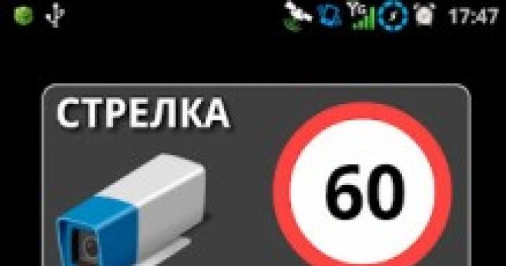
In addition, the navigator has a function that additionally informs about installed cameras and speed bumps. The display of items on the map is fully consistent with reality. This option is available when the 3D Motion mode is enabled. The database of city maps always contains the necessary information about the location of gas stations, service stations, shops, food and accommodation points, as well as, if necessary, about medical institutions.
The installed SMS service from Navitel allows you to constantly send free messages indicating the exact location if the car suddenly gets into an unpleasant situation on the road. The Weather service allows you to get the most accurate forecast without spending any money. Of the additional functions, you can view videos both from the Internet and from a flash card, listen to music files. Most importantly, all the necessary documents for resolving traffic situations with the traffic police can be kept at hand.

Settings
The advanced settings that the navigator for trucks is equipped with can ensure the best work. Driver feedback suggests that all the options on the Navitel A730 are very simple and convenient in their location. Now you do not have to constantly search for something. The high quality of the sensor will allow you to accurately enter information about the route. In the route settings, there is a function that includes the search for roads.

It will become a convenient device for ordinary drivers who love to travel, and for those who work in the delivery service, as well as for truckers. A wide range of functions will not allow both the driver and passengers to get bored on the road. And this is very important, especially over long distances. It should be noted that the navigator is made of durable plastic, therefore, in the event of an unintentional fall, it will not shatter into different parts, but will remain safe and sound.
Choose the best routes for huge trucks and get to your destination safely and on time: Professional navigation is already available for all types of trucks. This program has a unique ability to do everything that is required to do according to the rules of navigation laws - and it also takes additional information from trucks into account the power, height of the transport of all restrictions). The path is designed specifically for large vehicles, saves time and money from the beginning of the route, since the program is only created for different cargo vehicles, and will show the route that is shorter and faster to the specified destination.
- Map Guide Truck Navigator 2019 shows all road closures, road restrictions and dangerous areas. Path creation navigator was created for trucks. Let's take into account the data that is stored on the card:
- Roads where trucks are not allowed.
- Restrictions on environmentally hazardous goods (polluting, explosive and harmful substances), as well as roads closed to trailers.
- Truck data (height of the truck, axle load, presence of dangerous cargo in your car) will be shown on the navigator until the end of the journey, at any time of the day or night. With these abilities, navigation always gives information about road closures or other important information (empty or busy roads) into account. There are no restrictions on creating different profiles that you can save and then select with a single keystroke.
- The Map Guide Truck Navigator navigation system warns all truck drivers about dangerous sections of the road.


The navigator provides the truck driver with a map with a planned route and to travel through settlements. Each driver decides for himself how to avoid narrow roads and exit into the city. Any routing profiles can be selected for the purpose you need.