In Russia, some roads are toll roads. In the Kaluga region, a toll road was built in 2019 under the name M3 “Ukraine”.
How much it costs to travel along this route depends on what category the vehicle belongs to and how far it will travel without deviating from the route. The time of day when the car crosses the toll road is also important.
How to determine the vehicle category
Crossing the M3 Ukraine highway in 2019 requires payment of a certain amount of money. The tariff was last revised in May 2019. The cost of travel on this route depends, among other things, on the category of vehicle. It is determined based on the following parameters:
- The first category includes passenger cars that can be equipped with a trailer up to 2 m high. This also includes multi-purpose vehicles and motorcycles.
- Experts include medium-sized vehicles in the second category. Cars with a trailer within 2.1-2.6 m are allowed. If a Russian owns a van on a passenger chassis, this is also the second category. Pickup trucks and minivans are also called midsize vehicles.
- The third category is characterized by trucks and vehicles that carry passengers with a small trailer.
- If the truck or passenger vehicle is equipped with a trailer up to 3 m, this is the fourth category.
Where are the toll sections of the M3 "Ukraine"
The M3 "Ukraine" highway is of federal importance. Therefore, there are two toll sections on the route, which cost drivers money to travel through. The areas are located as follows:
- from km 124 to km 150;
- from 159 to 194 km.
There is a whole list of tariffs for the section from km 124 to km 150:
- If the toll road is crossed by category 1 vehicles from 7 to 24 hours, you have to pay in the range of 40-50 rubles, depending on the payment method.
- If we are talking about category 2, the driver will have to pay from 60 to 75 rubles.
- For the 3rd category of transport, the tariff ranges from 80 to 100 rubles.
- Owners of category 4 vehicles must deposit money in the amount of 144-180 rubles. By driving on toll roads from 24 to 7 hours, you can significantly save money. After all, the tariff has been halved for all transport items.
For those who travel along the M3 “Ukraine” toll road from km 150 to 194 and adhere to the 7-24 hour schedule, the following prices apply:
- Owners of category 1 vehicles pay 64-80 rubles.
- Managers of vehicles belonging to the 2nd category will pay 96-120 rubles.
- For category 3, the tariff increases to 128-160 rubles.
- For owners of the 4th category, crossing the M3 “Ukraine” route will cost 256-320 rubles.
From 24 to 7 hours the tariff is also halved. If the journey affects both sections of the toll federal highway M3 “Ukraine” at once, by paying for the entire route, there is an opportunity to significantly save money:
- For owners of category 1 vehicles, the trip will cost 104-130 rubles, depending on the chosen method of depositing money.
- If a category 2 vehicle is moving along the road, the costs will be 156-195 rubles.
- For owners of category 3 vehicles, the trip will cost 208-260 rubles.
- Drivers will be asked to invest 400-500 rubles from their own pockets for category 4 transport.
If you want to save on the entire toll highway M3 “Ukraine”, try to travel along the route from 24:00 to 7:00. This schedule implies a half-reduced payment rate.
That's why, when traveling on one of the daily private buses, the ticket may cost more. Then, to save money, it is better to find out the train schedule. The help desk will help with this.
How to pay less on the M3 Ukraine toll road
To ensure that travel on the M3 “Ukraine” toll road does not cost a pretty penny, it is important not to give up using a transponder. This is a device that allows you to deposit money without stopping at payment stations. You can purchase a transponder in the office premises located in front of the entrance to the highway if you are moving from the capital. Also, offices with transponders are located at the exit towards the capital.
A convenient gadget is fixed inside the car to the windshield, immediately behind the mirror showing the rear view. The battery is built inside the device by default. It usually lasts for 5 years of active use. If the battery or transponder deteriorates earlier, you can ask the operator to change them without paying a fee.
Federal highway M3 "Ukraine" (Kyiv highway) is a federal highway.
Moscow - Kaluga - Bryansk - state border with Ukraine. Part of the European route E101.
It was finally put into operation in 1976.
The continuation of the road through the territory of Ukraine is the M-02 (E101) highway in the direction of Kyiv and Odessa.
The length of the highway is 510 kilometers.
The width of the M-3 "Ukraine" highway is 7 meters.
It passes through the territory of the Moscow, Kaluga, Bryansk and Kursk regions.
The route has access roads to: Kaluga (16 km), Bryansk (20 km), Sukhinichi (5 km).
The speed limit along the entire route is 90 km/h, with the exception of populated areas and other restrictions. 
A number of road sections require increased driver attention:
- with steep descents and ascents (245 km);
- with sharp turns and areas with limited visibility (50 km, 167 km, 220 km, 426 km).
The road crosses significant rivers: Nara (near the town of Naro-Fominsk), Sukhodrev (near the settlement of Detchino), Ugra and Oka (near the town of Kaluga), Zhizdra (near the town of Zhizdra), Snezhet (near the settlement of White Shores).
All bridges have a load capacity of 60-80 tons.
Route
The M3 road begins at the intersection of Leninsky Prospekt and the Moscow Ring Road, then runs in a southwestern direction through the territory of the Moscow region, passing south of the Solntsevo district of Moscow and Vnukovo airport.
Before the junction with the A107 it is a modern motorway with interchanges, elevated pedestrian crossings, a median and 4-5 lanes in each direction.
After 37 kilometers the road narrows to three lanes in each direction.
In Selyatin the road narrows to two lanes in each direction. Further, the M3 highway passes along the southern outskirts of the city of Naro-Fominsk.
Then the road goes through the territory of the Kaluga region, crossing the A101 highway near the city of Obninsk, passing by Kaluga at a distance of 16 kilometers west of the city (crossing P93).
Then it goes through the territory of the Bryansk region in a southern direction, lying at a distance of 10 kilometers east of Bryansk and intersecting with the A141 highway, passes several kilometers through the territory of the Kursk region, turns southwest at the junction of the Orel - Kiev highway and reaches the state border with Ukraine. 
Start
(30 km)
Vnukovo
(67 km)
Naro-Fominsk
(90 km)
Balabanovo
(101 km)
Obninsk
(168 km)
Kurovskaya.
Access to Kaluga (16 km)
(382 km)
Turn to Bryansk.
Highway A141 (10 km)
(479 km)
Sevsk
(510 km)
Sopych.
State border with Ukraine.
On the territory of Ukraine, the highway continues as the M-02 highway to Kharkov and M-18 Kharkov - Zaporozhye - Simferopol - Yalta.

Alternative free passage of vehicles
1. Exit from the public highway of federal significance M-3 "Ukraine" at km 107 - public highway of federal significance A-130 Moscow - Maloyaroslavets - Roslavl - border with the Republic of Belarus - public highway of regional significance 29 OP RZ 29K -009 "Kaluga - Medyn" - Kondrovo - public highway of federal significance M3 "Ukraine" (access to Kaluga) - public highway of regional significance 29 OP RZ 29K-001 Vyazma - Kaluga - public highway of regional significance 29 OP RZ 29K-002 Babynino - Vorotynsk - Rosva turn - before the intersection with the public highway of federal significance M-3 "Ukraine".
- Length - 135 km.
- Category - III - IV.
- Number of lanes - 2
- The width of the roadbed is 15 meters.
- The width of the roadway is 2 x 3.75 meters.
- Type of coating - asphalt concrete.
2. Exit from the M-3 "Ukraine" highway at km 107 - highway A-130 Moscow - Maloyaroslavets - Roslavl - border with the Republic of Belarus - public road of regional significance 29 OP RZ 29K-018 ring road of Kaluga - Detchino - Maloyaroslavets - public highway of federal significance P132 Kaluga - Tula - Mikhailov - 2 Ryazan. Bypass of Kaluga from M-3 "Ukraine" - public highway of federal significance M3 "Ukraine" (access to Kaluga) - public highway of regional significance 29 OP RZ 29K-001 Vyazma - Kaluga - public highway regional significance 29 OP RZ 29K-002 Babynino - Vorotynsk - Rosva turn - to the intersection with the public highway of federal significance M-3 "Ukraine".
- Length - 123 km.
- Category - III - IV.
- Number of lanes - 2
- The width of the roadbed is 6 - 9 meters.
- The width of the roadway is 2 x 3 meters.
- Type of road pavement - permanent.
- Type of coating - asphalt concrete.
The history of this highway goes back 80 years. The first design work began in 1938 Then it was called "Moscow - Sevsk".
Road work was stopped during the Second World War and continued when the country was able to overcome the consequences of war devastation.
In 1959, the section from km 107 to km 180 was completed.
In 1963 from 180 km to 300 km
In 1964 from 300 km to 425 km
The section from 425 km to 507 km was built simultaneously with the section from 180 to 300 km, since 1959, and was put into operation in 1963.
It was also built 23 roadside engineering structures— pipes and channels for the passage of melt and rainwater, crossings, transitions, etc.
According to the technical standards of the USSR, the road belonged to cement concrete of the second category. Construction in those years was carried out by three large general contractors - trusts "Kievdorstroy", "Tsentrdorstroy" And Glavdorstroy. Organizations were subordinated Ministry of Transport and Construction.
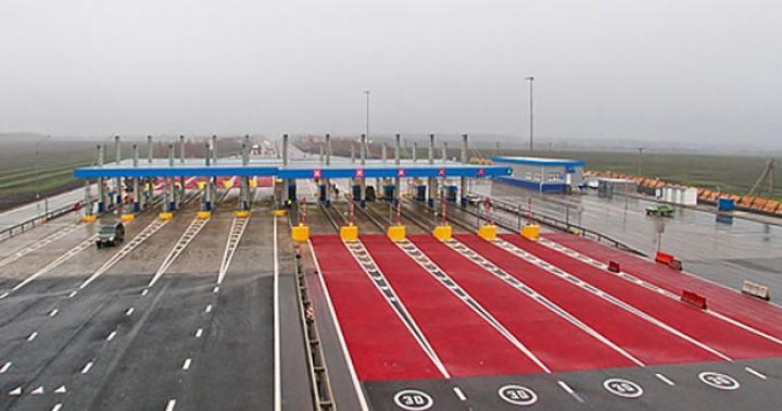
For many years after the collapse of the USSR, no major work was carried out on the highway. But only spring 2017 the section from 124 to 173 kilometers was put into operation toll fare.
 located at 168 and 136 kilometers. According to current legislation, each section of a toll road must have alternative free travel option.
There are several in this area free route options and many interchanges and exits that allow you to access them. In particular, there are exits to a free section at 107 km near the city of Belousovo and at 173 km near the city of Kaluga.
Following the first improvement in road quality in decades, the second phase of full-scale work has been completed and end of 2017 has been open to motorists since one toll section, from 173 to 194 kilometers.
Payment at the newly introduced site it is produced at toll booth, located at kilometer 168. That is, the toll gates are not located so that motorists entering and exiting the highway between 174 and 194 kilometers pass for free.
All VFR on the highway "Ukraine" M-3 meet the recommendations for their equipment developed by the State Road Service (). Namely:
- modern control devices for entry and exit from the toll area,
- ticket issuing machines,
- means of monitoring and transmitting information about the number of vehicles driven and funds received.
The road got four stripes traffic with separate flows of oncoming vehicles. Instead of direct connections to the highway, secondary and equivalent roads were built at the same level safer two-level interchanges.
 The entire paid section illuminated at night time. All this made it possible to transfer the route from second technical category to first category, which fully meets modern requirements for the quality of roads.
Therefore, with October 5, 2018 speed limit on the new 20-kilometer section up to 110 kilometers per hour for cars and trucks with a carrying capacity of 3.5 tons. For heavier ones, the limit of 90 kilometers per hour remains.
Daily fee, from 7 to 24 hours for travel on these two sections depends on the power and weight of the car and ranges from 40 to 180 rubles, and night, from 24 to 7 am, exactly half as much.
According to the order of the head of the Government of the Russian Federation, Dmitry Medvedev, the site will remain paid for another 91 years, that is, until 2109.
Useful video
Highway M-3 “Ukraine” in the video below:
4,5 (263 votes) M-3Highway M-3 “Ukraine” (Kyiv highway)- a federal road in Russia. It starts in Moscow, then passes through Kaluga, Bryansk and ends at the state border with Ukraine at the Troebortnoye checkpoint. Continues through the territory of Ukraine under the number M-02. It is part of the European road route E 101.
The total length is 500 km.
The stationary traffic police post is located in the village of Alabino, Naro-Fominsk district, Moscow region, at 51 km of the highway.
Compared to other federal highways leading to the south, the M-3 road does not have very high traffic. In summer, the congestion on the route increases. There are significant queues at the border, which can reach several kilometers.
Number of lanes
For 30 km from the Moscow Ring Road the road has 8 lanes, then to Selyatino - 6 lanes, on the Selyatno - Muromtsevo section there are 4 lanes, the rest of the road has 2 lanes, one in each direction.
State
Overall the road is smooth and in good condition. The road surface is deteriorating in the area from the turn to Kaluga to the border with the Bryansk region.
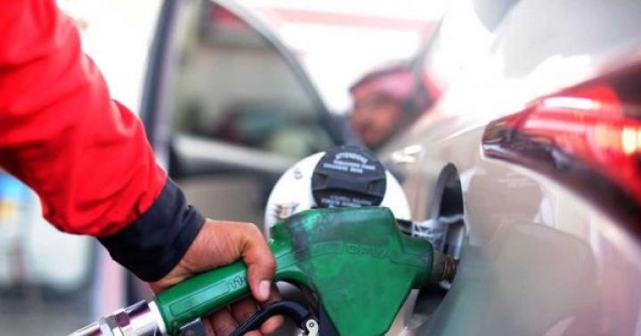
Gas stations
73 km – Gazpromneft (from Moscow)
73 km – Tatneft (from Moscow)
76 km - Lukoil (to Moscow)
83 km – Tatneft (from Moscow)
85 km - Lukoil (from Moscow, cafe)
85 km – Tatneft (to Moscow)
88 km - Shell (to Moscow)
107 km - Lukoil (to Moscow)
132 km - Lukoil (from Moscow)
143 km - Gazprom (to Moscow)
144 km - Lukoil (from Moscow, cafe)
149 km - Lukoil (to Moscow, cafe)
158 km - Gazprom (from Moscow)
166 km - Gazprom (to Moscow)
355 km - Lukoil (from Moscow, cafe)
424 km - Lukoil (to/from Moscow, cafe (right and left sides))
515 km - Lukoil (to/from Moscow, cafe (right and left sides))
Attractions
Obninsk - the Bugry estate (19th century), in the 20th century it was the dacha of the artist P. P. Konchalovsky, the remains of the Belkino estate with the Church of Boris and Gleb (1773), the cascade of Belkinsky ponds, the restored Belkinsky Park, 310-meter meteorological a mast included in the meteorological complex of NPO Typhoon;
Kaluga - stone chambers of Korobov (1697), stone residential buildings (XVIII century), Church of the Intercession of the Blessed Virgin Mary (1687) with a bell tower (XVIII century), St. George at the Top (1700- 1701), Transfiguration (1709), Sign (1720- 1731), Makarov's chambers (XVIII century), Obolensky's house (XVIII century), ensemble of Public places (1778- 1787), Trinity Cathedral (1786- 1819), Gostiny Dvor (1782- 1796), house of Zolotarev-Kologrivova (1805- 1808), Meshkov House (1826), Assembly of the Nobility (1848- 1850), Great Stone Bridge - a 160-meter stone viaduct in the Romanesque style (1775- 1778);
Bryansk - Mound of Immortality (1967- 1972), park-museum named after A.K. Tolstoy (1936), Gagarin Boulevard, Intercession Cathedral (1698), Spaso-Grobovskaya Church (1900- 1904), Svensky Monastery (presumably 1288).